Sunday, May 31, 2015

Devils Tower National Monument


Devils Tower is one of those places we kept meaning to see, but it's kind of out of the way so we never did.  We decided that this year we would take a little detour and check it out. It's pretty impressive. The Tower rises 1,267 feet above the surrounding terrain and the summit is 5,114 feet above sea level. It  was the first declared United States National Monument, established on September 24, 1906, by President Theodore Roosevelt.

Devils Tower was featured in the movie 'Close Encounters of the Third Kind.' We both remember the scene where Richard Dreyfus was making a tower out of a big pile of mashed potatoes, running his fork up and down the pile. Once we got close to the Tower we could see what he was trying to do. The photo below shows  how the rock runs in vertical strips. The parallel strips are so precise and even that they look like they've been chiseled into the rock.


Although the Tower is a popular climbing destination it is not without controversy. The Tower is sacred to several Plains tribes, including the Lakota, Cheyenne and Kiowa. Because of this, many Indian leaders objected to climbers ascending the monument, considering this to be a desecration. The climbers argue that they had a right to climb the Tower, since it is on federal land. A compromise was eventually reached with a voluntary climbing ban during the month of June when the tribes are conducting ceremonies around the monument. Climbers are asked, but not required, to stay off the Tower in June. Approximately 85% of climbers honor the ban and voluntarily choose not to climb the Tower during the month of June. However several climbers, along with the Mountain States Legal Foundation, sued the Park Service claiming an inappropriate government entanglement with religion. The climbers lost the lawsuit.
More information regarding the Tower and climbing can be found at the following link   http://www.nps.gov/deto/faqs.htm


The sculpture in the photo above is at the new Tribal Connections site, part of Devils Tower National Monument.  It interprets Devils Tower as a place that is sacred to many Native American tribes. The central feature, the Wind Circle sculpture – also called the Sacred Circle of Smoke -- was created by internationally renowned Japanese artist Junkyu Muto as the third in a series of seven “peace sculptures” planned for significant sites around the world. The Wind Circle sculpture, which is made of white marble with a black base, stands an impressive 12 feet tall. The artist designed it to evoke the image of a puff of smoke from a sacred pipe.


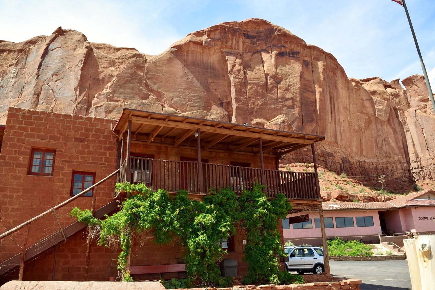
We had planned to hike around the base of the monument, but the weather wasn't cooperating. We spent some time in the Visitor Center learning more about the Tower.


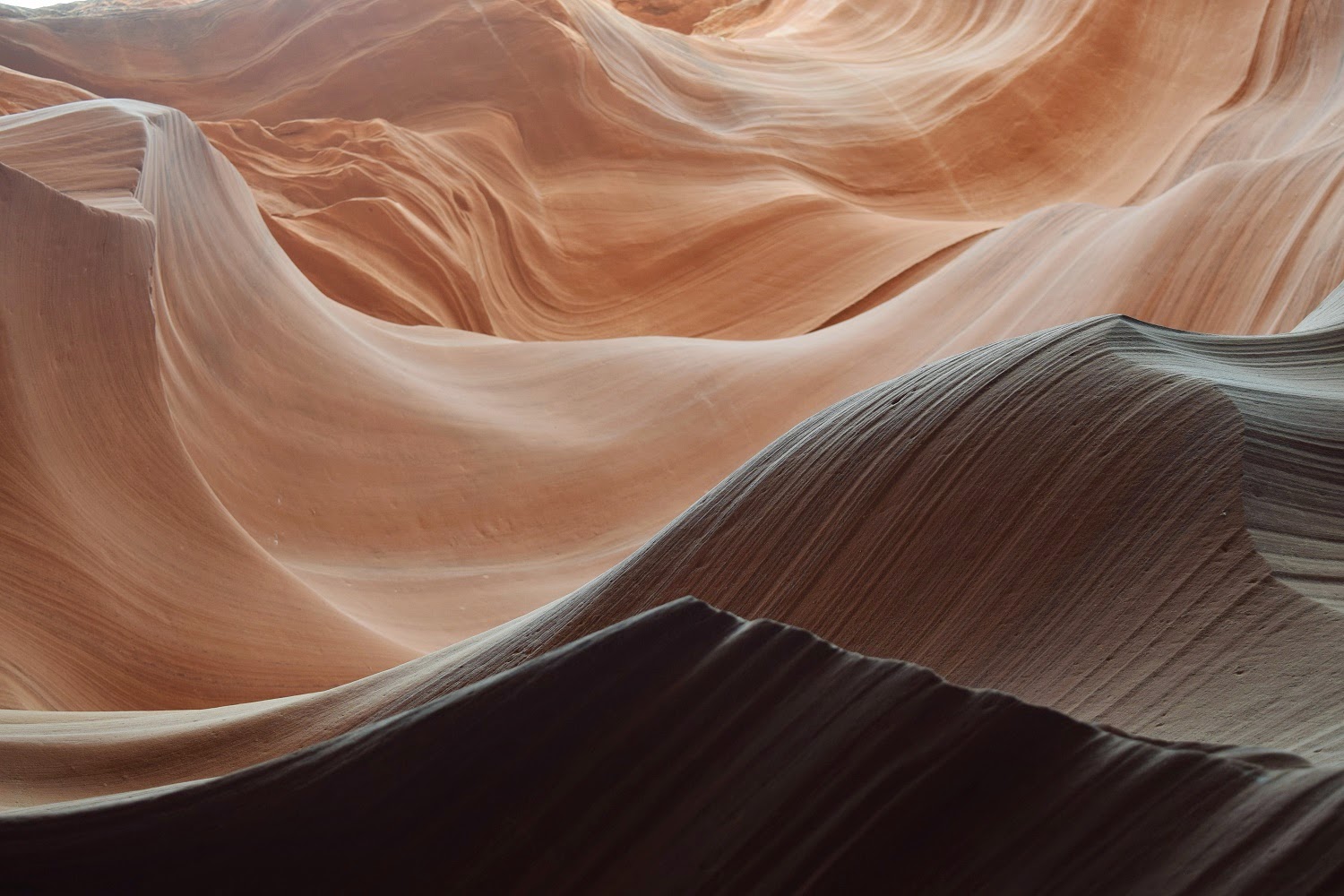
One of the things that I thought was interesting is that there is no definitive answer as to how the Tower was formed. There are three basic theories, kind of technical but interesting. The following link explains the geological theories     http://www.nps.gov/deto/learn/nature/geologicformations.htm

Native American stories telling how the Tower was formed are even more interesting. The stories all involve a bear trying to climb the Tower and are similar to this one from the Kiowa and Lakota tribes, 'Some girls went out to play and were spotted by several giant bears, who began to chase them. In an effort to escape the bears, the girls climbed atop a rock, fell to their knees, and prayed to the Great Spirit to save them. Hearing their prayers, the Great Spirit made the rock rise from the ground towards the heavens so that the bears could not reach the girls. The bears, in an effort to climb the rock, left deep claw marks in the sides, which had become too steep to climb. Those are the marks which appear today on the sides of Devils Tower. When the girls reached the sky, they were turned into the star constellation the Pleiades'.

It was a pretty interesting place to visit - just wish we had been able to do some hiking. Maybe next time.

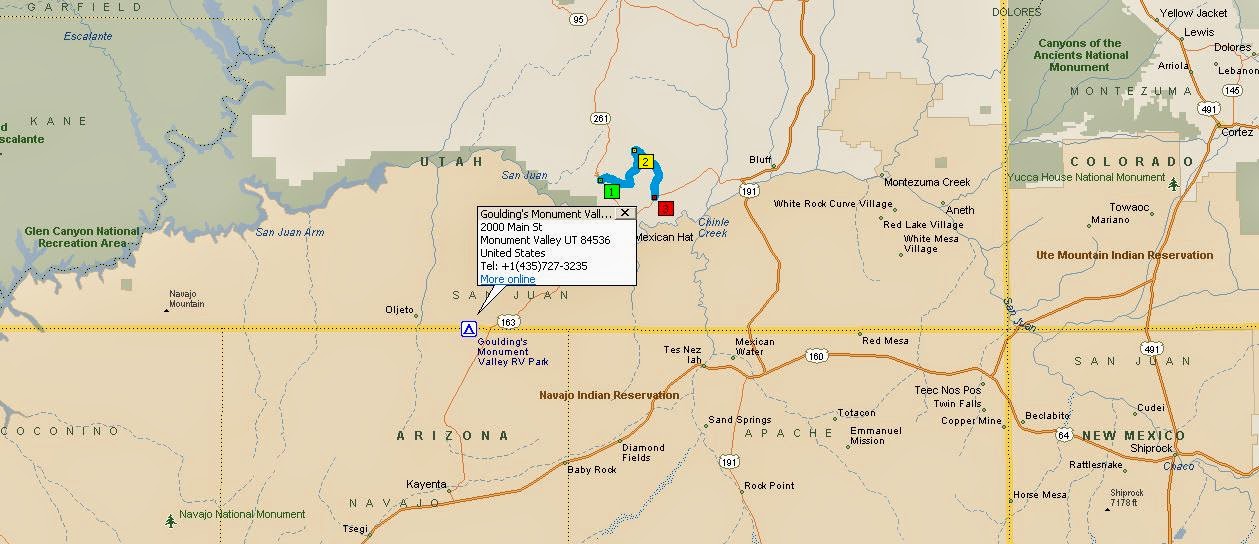
Following are maps of our route from Lyons to Sundance, Wyoming, where we stayed while exploring the Tower, and our route from there to Sioux Falls, SD.

Lyons to Lusk, Wyoming where we made our first overnight stop -  222 miles


Lusk to Sundance, Wyoming - 127 miles


Sundance to Presho, SD - 245 miles. Don't recommend stopping in Presho, but driving in the wind and rain got to be too much.


Presho to Sioux Falls, SD, our hometown. We have to return here every five years to renew our drivers licenses - 175 miles.


Rocky Mountain National Park Wildlife


It seemed a shame to be so close to Rocky Mountain National Park and not get up there for a brief visit. We have been amazed at how much snow is still on mountain peaks for this time of year. Friends have told us that most of it has fallen in the last few months.


Our first sight on entering the park was a huge field full of bull elk. More than we have ever seen in one place. Brian started counting and stopped at 35, but estimates there were more than 50. This seemed pretty unusual to us, but a ranger we talked to said that it was pretty common for this time of year. He also said that these were all younger bulls and he called this area the bachelor pad since none of them have their own herd of cows. It isn't until the fall mating season that the bulls get territorial.


The whole concept of growing and shedding antlers has always interested us. Brian's research explains a lot about it. From good old Wikipedia -
'Antlers are extensions of the skull grown by members of the deer family. They are true bone structures that usually grow in symmetrical pairs. In most species, only the male grows antlers and their primary function is to increase his likelihood of sexual selection by attracting females or helping him fight other males. In many temperate zone species, antlers are shed and regrown each year.
Antlers are unique to cervids and found mostly on males: only reindeer have antlers on the females, and these are normally smaller than those of the males. Nevertheless, fertile does from other species of deer have the capacity to produce antlers on occasion, usually due to increased testosterone levels

Each antler grows from an attachment point on the skull called a pedicle. While an antler is growing, it is covered with highly vascular skin called velvet, which supplies oxygen and nutrients to the growing bone. Antlers are considered one of the most exaggerated cases of male secondary sexual traits in the animal kingdom, and grow faster than any other mammal bone. Growth occurs at the tip, and is initially cartilage, which is later replaced by bone tissue. Once the antler has achieved its full size, the velvet is lost and the antler's bone dies. This dead bone structure is the mature antler. In most cases, the bone at the base is destroyed by osteoclasts and the antlers fall off at some point. As a result of their fast growth rate, antlers are considered a handicap since there is an immense nutritional demand on deer to re-grow antlers annually, and thus can be honest signals of metabolic efficiency and food gathering capability.'


Since the antlers on these younger elk are new growth, they still have a ways to go. The older and larger the bull, the larger the antlers.
This little guy has a ways to go - he reminded me of Tilly as he was trying to reach around and scratch his ear.


The elk were sharing the meadow with what I think are female and/or juvenile Rocky Mountain sheep.


The weather wasn't very cooperative during our time in Colorado. Too much rain and cold, but we're glad we took the time to get up to the park anyway.

Map of route from Lyons to Rocky Mountain National Park.


Sunday, May 24, 2015

Colorado

After leaving Monument Valley we headed for Colorado City, Colorado. We stopped for the night in Bayfield, Colorado, which is just east of Durango.  When we checked into the RV park the woman at the desk told us to chase off any big gray birds we saw because they were eating all the little fish in the newly stocked pond. I guess this is what she was referring to, a heron.


From Bayfield we went to Colorado City, just south of Pueblo. The car and Bus encountered their first snowfall there. Pretty crazy for this time of year.


We spent a week parked in Colorado City but spent most of our time with friends Marlene and Dan in Beulah where they have a wonderful home in the mountains.  Always fun, just wish the weather would have been better. Lots of rain, hail and the above mentioned snow but we did get a bit of sunshine. Brian kept Dan company while he grilled one of our delicious dinners


and Marlene kept the wine flowing. What more could you ask for?


From Colorado City we headed north to Lyons, Colorado. This is the area where Brian and I spent the majority of our adult lives. We were here two years ago and had to be evacuated during the big flood. It's sad to see the changes that have occurred in Lyons since the flood, and to see how much work still needs to be done. After almost two years there are homes that will never be rebuilt, homes under construction, homes with sandbags around them, and many people are still living in trailers while working on their houses. Sandbags can be seen around the house below, trailers to the left.


The RV park we like to stay at in Lyons is up and running again, and is actually much nicer than it was before. Long, wide spaces and some nice grassy areas. When it isn't raining (way too much of that this year) we have been enjoying the park.


We have seen eagles and their babies here several times, and they appear to be back this year.


Our route from Monument Valley to Bayfield then Colorado City, with a jog out to Beulah before heading for Lyons


Tuesday, May 19, 2015

Overlanders


In our travels we run across a type of vehicle we call Overlanders. Some, like the one above, are actual Overlanders. Others that we call overlanders are vehicles that have been manufactured or modified to go just about anywhere, and they do. We had an interesting conversation with the couple traveling in this RV. They have traveled extensively as seen on their map below.

 
Their website is at www.overlandhb.co.za  It tells a bit about them and where they've been.

Monument Valley


After leaving Page we stopped in Monument Valley for a few days. We've been there several times and each time we seem to discover something new and have some new adventures.We didn't spend time driving around the Navajo Park loop but spent our time in a few other places.

Gouldings Trading Post


The trading post has quite a bit of significance for Brian's family. During the 1950s Brian's Aunt Mary and her husband Martin Gambee lived at the trading post. Martin spent most of his time painting or being with the various film crews making movies in the area. Mary was kind of stuck running the trading post.
The trading post is now a museum that is supposed to be set up much the same as it was back then. I can just picture Mary behind the counter, both telling and listening to some wonderful stories.


It wasn't clear who lived upstairs but we think it was Mike and Harry Goulding. The painting to the left of the window in this photo is one of Martin's.


In addition there are three watercolors painted by Martin in the museum. One is shown below.


The Moki Dugway


The Moki (Mokee, Moqui) Dugway is a narrow, winding gravel road that climbs 1200 feet from the valley floor to the mesa top. Signs approaching the dugway recommend that only vehicles less than 28 feet and 10,000 pounds attempt to negotiate the dugway. It offers some spectacular views of Monument Valley and Valley of the Gods.


In the photo below you can barely see a propane truck making its way slowly down the dugway. There are several spots where only one vehicle will fit so it pays to look and plan ahead. 


It's a fun drive but I wouldn't want to attempt it in anything but a car.

The Valley of the Gods


This was our first visit to the Valley of the Gods, and we thought it was pretty spectacular. Kind of a mini-Monument Valley. There is a 17 mile loop that winds around and the valley can be entered from either the east or the west. Lots of interesting rock formations and landscapes. The figure on the formation above reminded us both of a brand of honey that was sold in a clear plastic bottle of a bear wearing a hat with its arms crossed.

The photo below is called balanced rock for obvious reasons.


The other name for the balanced rock formation is Lady in a Tub. We didn't get it until we went around the corner and got a different view.


This formation is called Seven Sailors because there are seven flat sailor caps on the rock tops.


We really enjoyed Valley of the Gods - can't believe we never went there on any of our Monument Valley trips.

Some maps....

Overview of the area. Gouldings Trading Post is marked, the blue line shows the Valley of the Gods.


The Moki Dugway is on Utah Hwy 261 which runs 34 miles north from the junction of U.S. Route 163, 3 miles north of Mexican Hat, It joins State Route 95 just east of Natural Bridges National Monument. Hopefully people are checking their maps and are aware of the limitations going this route!


The Valley of the Gods Loop. 1 is the West Entrance on Utah Hwy 261 about 10 miles northeast of Mexican Hat, 2 is Castle Butte rock, and 3 is the East Entrance on US Hwy 163 about 7 miles east of Mexican Hat.


Our route from Page, AZ to Monument Valley, UT


Monday, May 18, 2015

Antelope Canyon


Antelope Canyon is a slot canyon on the Navajo Tribal Lands near Page, Arizona. There are two canyons, the Upper and the Lower, that are open to tourists accompanied by a Navajo guide. The two canyons are very different. The Upper Canyon is narrow at the top and wider at the bottom. It is a fairly easy walk and there are usually a lot of people. The tour goes in, reaches the end, turns around and comes back out. It can be really crowded. The Lower Canyon is wider at the top and narrow at the bottom. There are narrow passages and climbing up and down ladders and steps is required. The entrance to the Lower Canyon drops about 50 feet.


Once in the canyon we had to go pretty much single file in one direction until we reached the end where we climbed back out. We had done the Upper Canyon twice and the Lower Canyon once in previous years. This year we went back to the Lower Canyon which we much prefer - fewer people and we weren't hurried along so that the next tour could go through. Our guide took some photos of us as we went through the canyon.


Antelope Canyon is one of the most photographed places in the world for a good reason. We took so many photos that it's hard to pick out which ones to put in the blog. Here are some of our picks for now.


Notice the bird's head in the photo below - looks like an eagle or hawk maybe.


We saw faces in many of the rock formations - just have to use your imagination.


The one below looks like an Indian chief.


This one reminds us of some kind of screaming phantom.


We think this looks like a shark coming out of the waves.


Our route from Flagstaff to Page